Photos of research, education, and outreach activities by members of the Ecohydrology and Watershed Science Lab
-
-
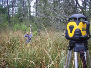
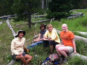
Elevation survey at Goose Creek
-
-
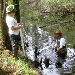
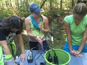
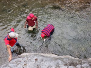
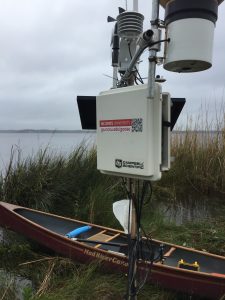
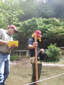
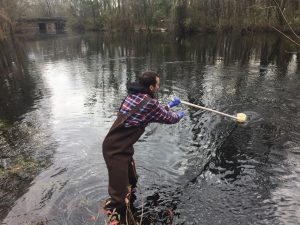
Ivy Gut salinity monitoring
-
-
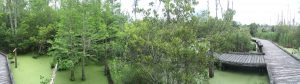
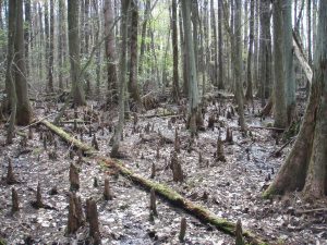
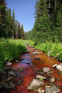
Palmetto Swamp is a freshwater-dependent coastal wetland at Goose Creek State Park on North Carolina’s Albemarle-Pamlico Peninsula.
-
-
The Confederated Salish and Kootenai Tribes manage water resources on the Flathead Indian Reservation in western Montana. Workshop participants tour a lake on the reservation during an indigenous water workshop in 2018.
-
-
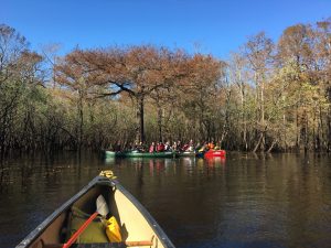
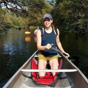
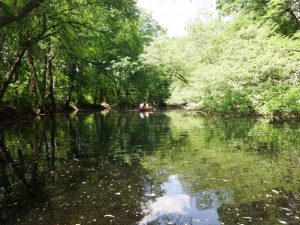
FOR 420/520 students canoe along the Black River.
-
-
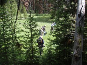
Scientists hike through the Stringer Creek watershed, deploying instruments to measure carbon dioxide and methane concentrations in soils.
-
-
Natural Resources students from the National Agricultural University of Honduras learn about stream discharge and water quality monitoring on the Talgua River in the Sierra de Agalta National Park.
-
-
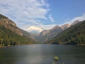
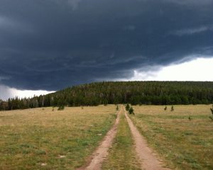
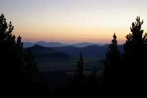
An August thunderstorm moves over the Little Belt Mountains of central Montana
-
-
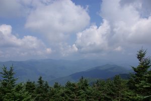
From the summit of Mount Mitchell (2,038m), students view clouds washing over the spruce-fir forest of southern Appalachian “Sky Islands.”
-
-
Water quality at the Haliwa Saponi Tribal School
-
-
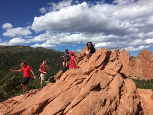
Students from the American Indian Science and Engineering Society visit Garden of the Gods during the 2017 National Conference in Denver.
-
-
The Lumbee community of Prospect is the proposed terminus for the Atlantic Coast Pipeline, a 600-mile pipeline designed to carry shale gas from the central Appalachian Mountains to the east coast of the United States.
-
-
Mountain Ecohydrology Field Course
-
-
Baldcypress knees emerge from a wetland in the headwaters of the White Oak River in eastern North Carolina.
-
-
Lab members and local residents install sensors to measure streamflow and water quality in the Talgua River, the main water supply for farming communities in the region.
-
-
The “Phone Booth” overlook on US Forest Service lands immediately adjacent to the Tenderfoot Creek Experimental Forest in central Montana. One of the few places with cell phone reception during the mid-2000s and a favorite spot to watch sunrises with students after pre-dawn fieldwork.
-
-
Emanuel visited students and faculty at Northwest Indian College during the Geological Society of America’s 2017 annual meeting in Seattle.
-
-
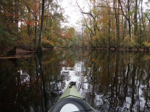
Pamlico River
-
-
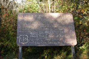
Coweeta Hydrologic Lab
-
-
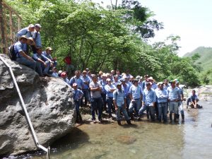
Students sit outdoors for a written exam at the National Agricultural University of Honduras. The campus is located in the town of Catacamas in central Honduras
-
-
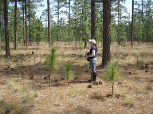
Undergraduate researcher measures longleaf pine forest properties in the Sandhills of North Carolina
-
-
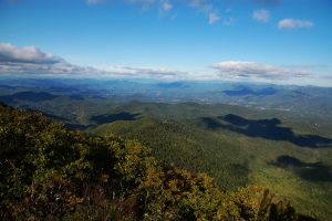
Coweeta Hydrologic Lab is an experimental watershed in western North Carolina. The Albert Mountain fire tower provides an excellent vista of the lab and surrounding Blue Ridge Mountains.
-
-
Justine Neville Fieldwork
-
-
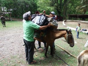
Preparing a pack horse to carry a weather station and stream gage into the Sierra de Agalta National Park near Catacamas, Honduras.
-
-
Stream metabolism experiment in Montana
-
-
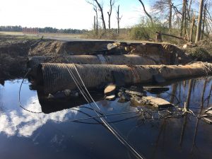
Saddletree Swamp, a tributary of the Lumbee River, flooded in the wake of Hurricane Matthew, damaging homes and infrastructure.
-
-
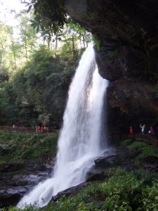
NC State students tour Cullasaja Falls during a watershed hydrology field trip to western North Carolina.
-
-
Honduras Fieldwork
-
-
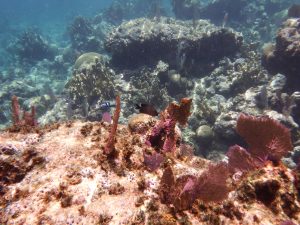
Exploring the Mesoamerican Reef off the coast of Honduras after installing monitoring equipment far upstream in the headwaters of the Platano River.
-
-
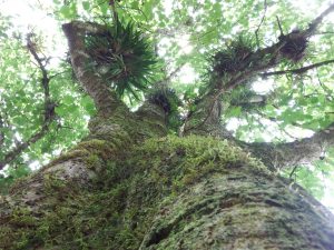
Air plants in the forest canopy of La Tigra National Park, Honduras.
-
-
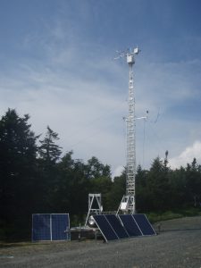
Flux tower at Roan Mountain, NC
-
-
Students paddle canoes down the Lumbee River in southeastern North Carolina.
-
-
The Coharie Tribe works to reclaim ancestral territory along the Great Coharie River in eastern North Carolina.
-
-
Researchers collect water samples from Big Marsh, a tributary of the Lumbee River, after Hurricane Matthew caused record-breaking floods to the region.
Scroll Up